|
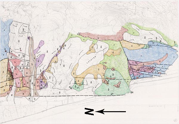
Index to Geologic Map of the Amantea-San Lucido Coastal Strip of the Catena Costiera, Calabria, Italy (Click on Map for larger scale copy) |
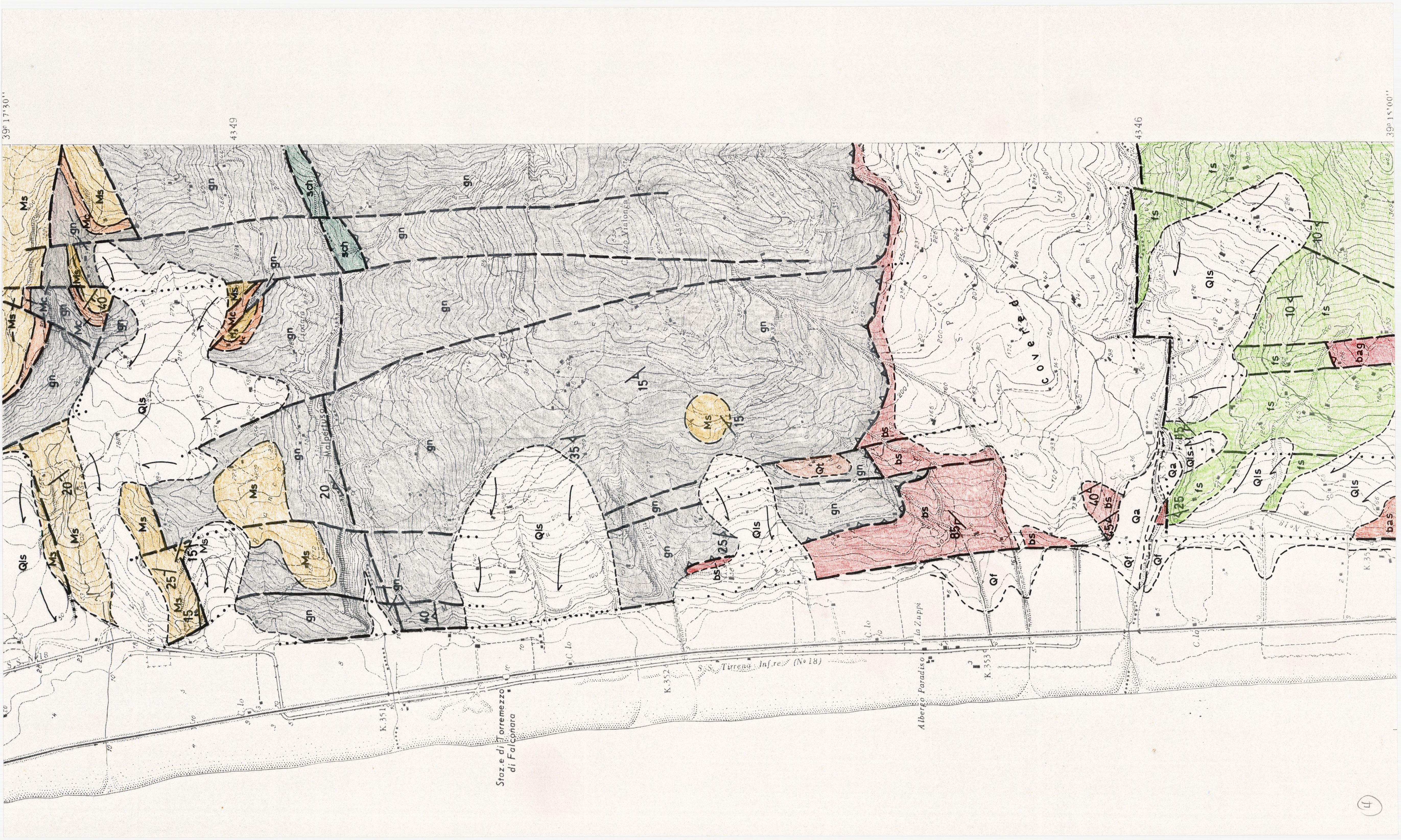
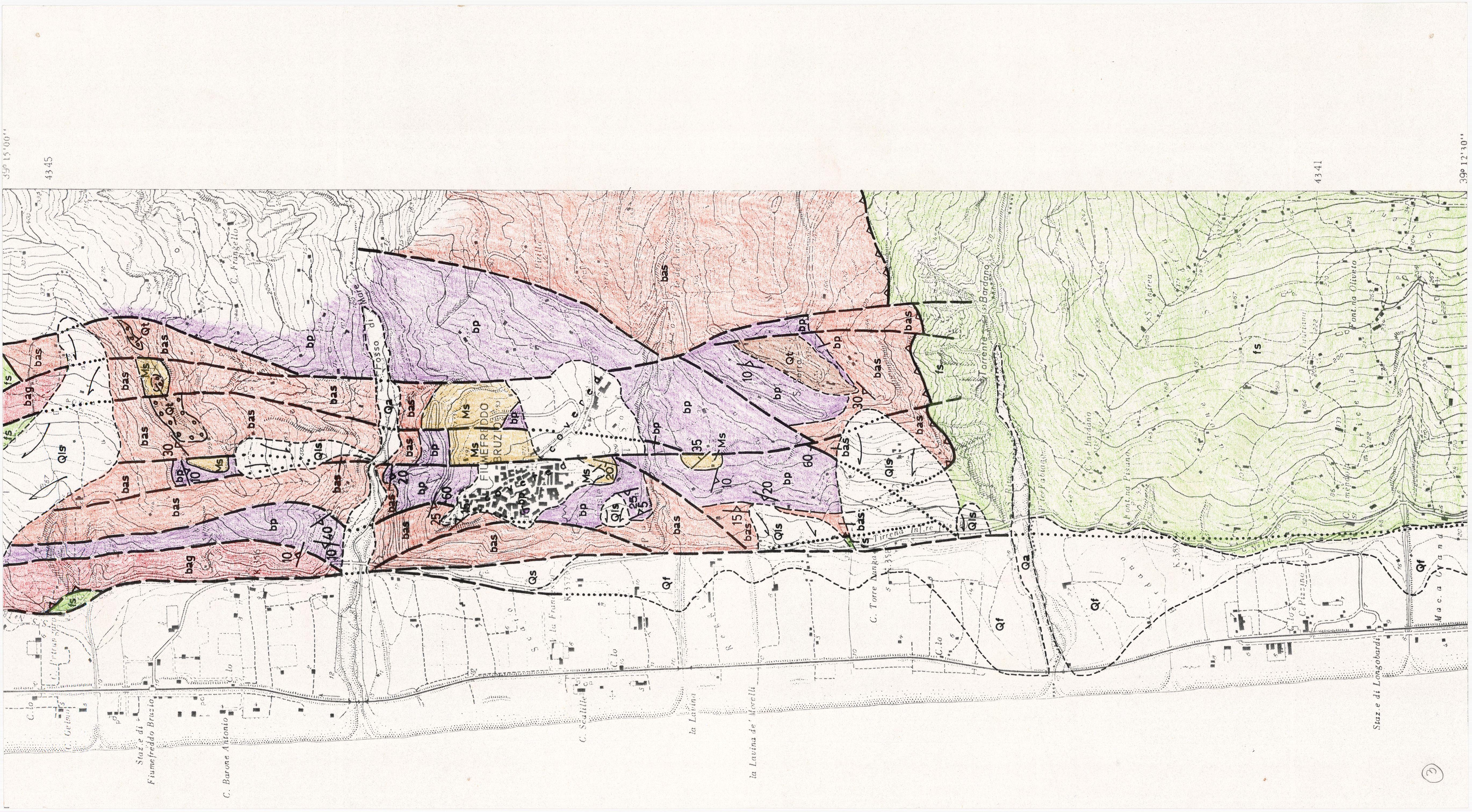
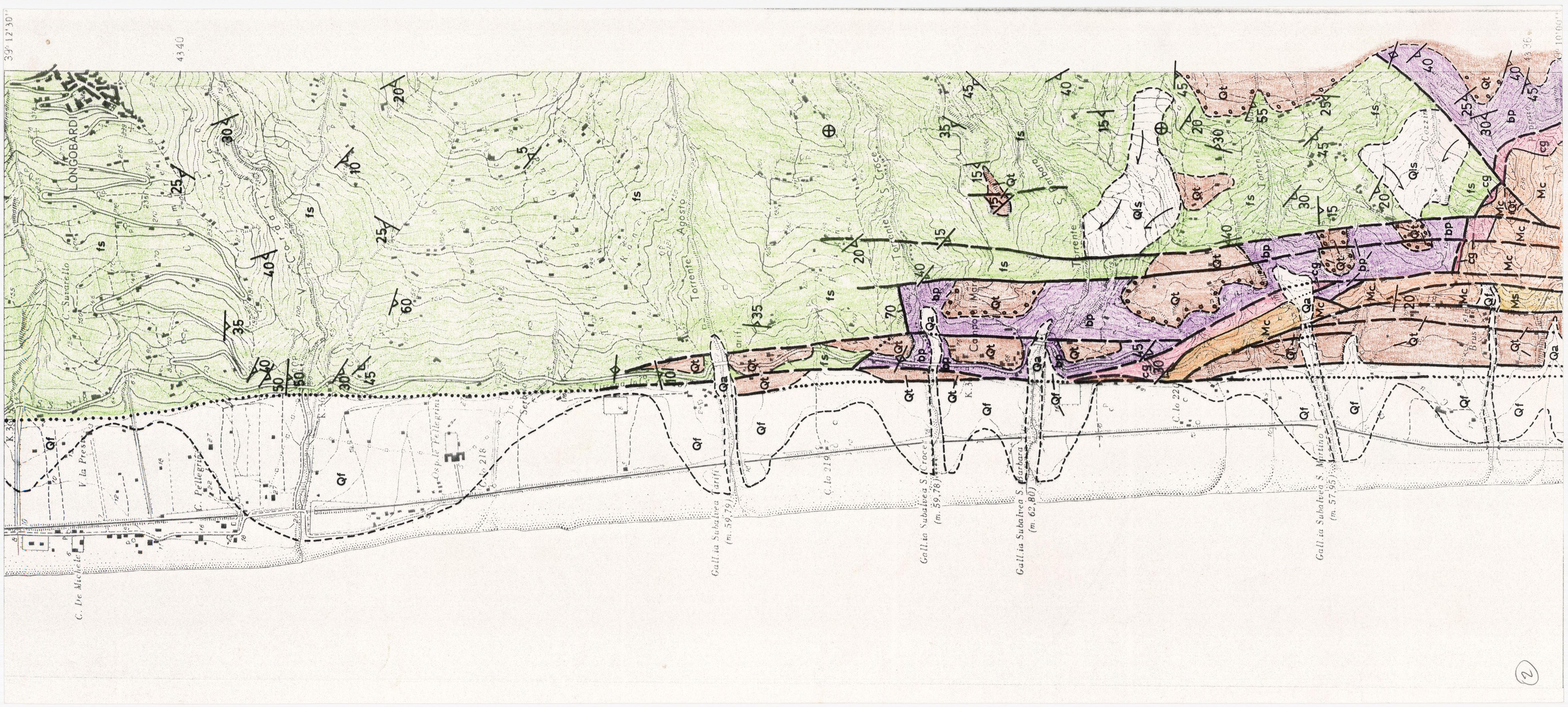
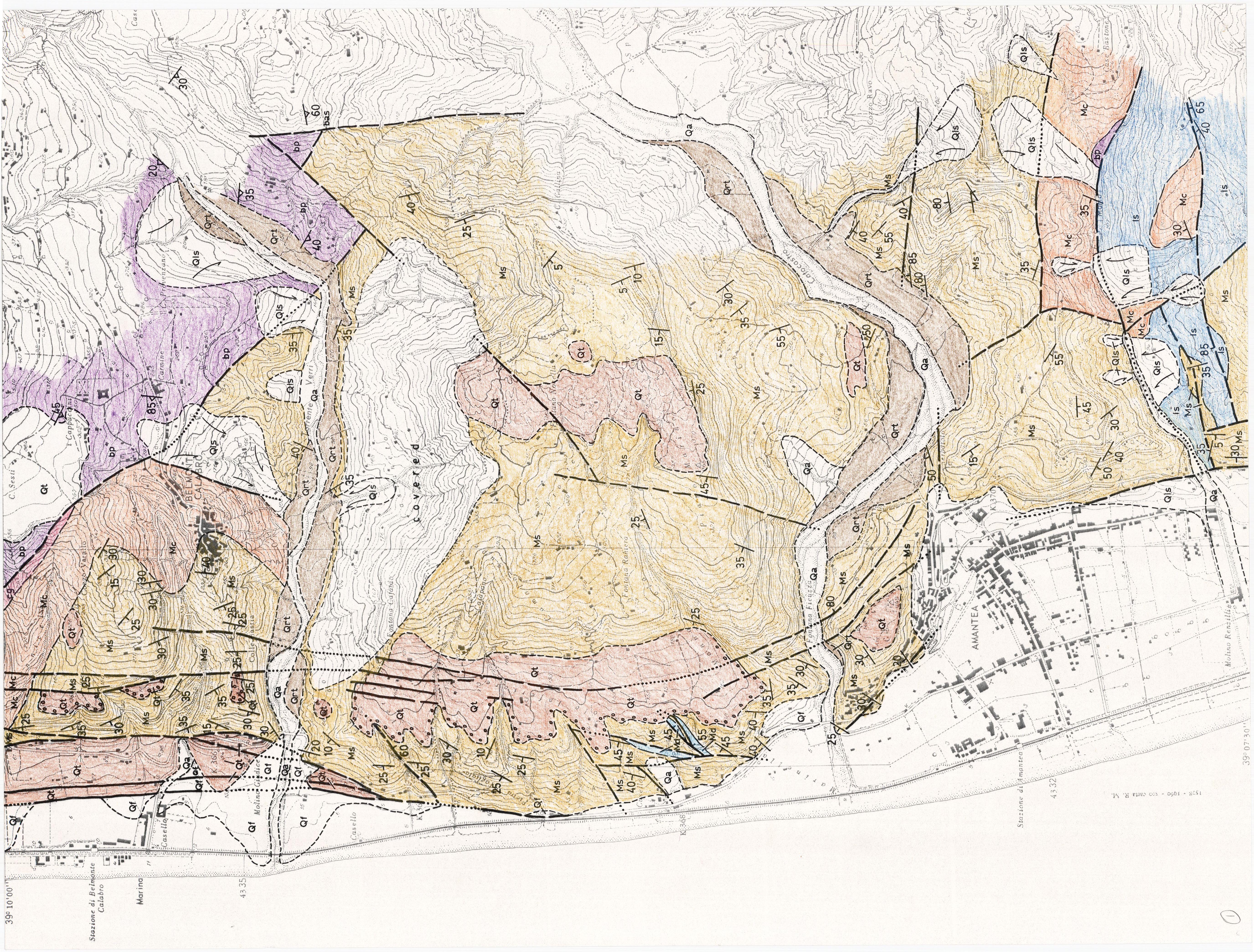
| Geologic symbols: gn = garnet gneiss of the Polia Copanello Formation (pre-Triassic); gr = granite; cg = biotite gneiss of the Castagna Formation (pre-Triassic); bas = augen schist, bag =augen gneiss, bp = phyllite of the Bagni Formation (Jurassic to Cretaceous; bs = chlorite schist (probably of Bagni Formation); sch = schist of unknown affinity (Bagni Formation?); ss = greenschist of Frido Formation (Late Cretaceous); ls = limestone, p = phyllite of San Donato Formation (?)(mid Triassic to Paleocene); Ms = sandstone; Mc= conglomerate; Md = dolomite (late Miocene and early Pliocene); Qa = alluvium in active stream channels; Qls = landslide deposits; Qt = terrace sand and gravel (very thin or extremely discontinuous on upper terraces); ols = old landslide deposit; all of Quaternary age. |
| Map Sheet 4 - Ponte Domba north to T. Malpertuso | |
| Map Sheet 3 - Longobrdi north to Fosso di Mare | |
| Map Sheet 2 - T. Cozzino north to Longobardi | |
| Map Sheet 1 - Amantea and Belmonte Calabro areas | |
| Map Sheet 0 - Grotto della Stritola north to T. Calcato | |